Flood forecast: Second-highest flood crest predicted for area, three feet below 2011 record
Published 10:19 am Saturday, May 25, 2019

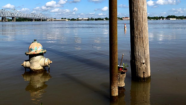
- A fire hydrant is surrounded by floodwaters along Silver Street in Natchez Saturday. (Ben Hillyer / The Natchez Democrat)
NATCHEZ — The National Weather Service is predicting what could be the second-highest recorded flood for the Mississippi River in Natchez.
Weather service officials say the river is projected to reach 59-feet at the Natchez gage at 7 a.m. Friday, June 7.
At 8 a.m. Saturday, the river was at 57.31 feet and rising. Flood stage in Natchez is 48-feet.
The record flood for the Mississippi River in Natchez was set on May 19, 2011, when the river reached 61.95 feet. The second highest flood was recorded in 1937 when the river reached 58 feet. Current projections would beat that record.
Each day the National Weather Service issues a 28-day forecast based on the amount of rainfall predicted in the next 48-hours. Heavy rains and storm are predicted to dump rain across the Central Plains and the Midwest, National Weather Service meteorologist Dan Byrd said Saturday morning. With the Missouri and the Arkansas rivers already filled to capacity any additional rainfall will cause more problems through the Mississippi River Valley, Byrd said.
“It has been kind of an accumulation thing,” Byrd said. “It all feeds in the Mississippi River.”
Each new weather system has the potential to create additional problems, Byrd said.
In Natchez, the river has been slowly rising for weeks and has been above flood stage for 140 days, a record for the area.


