Freezing weather expected to last through Tuesday
Published 5:06 pm Monday, February 15, 2021
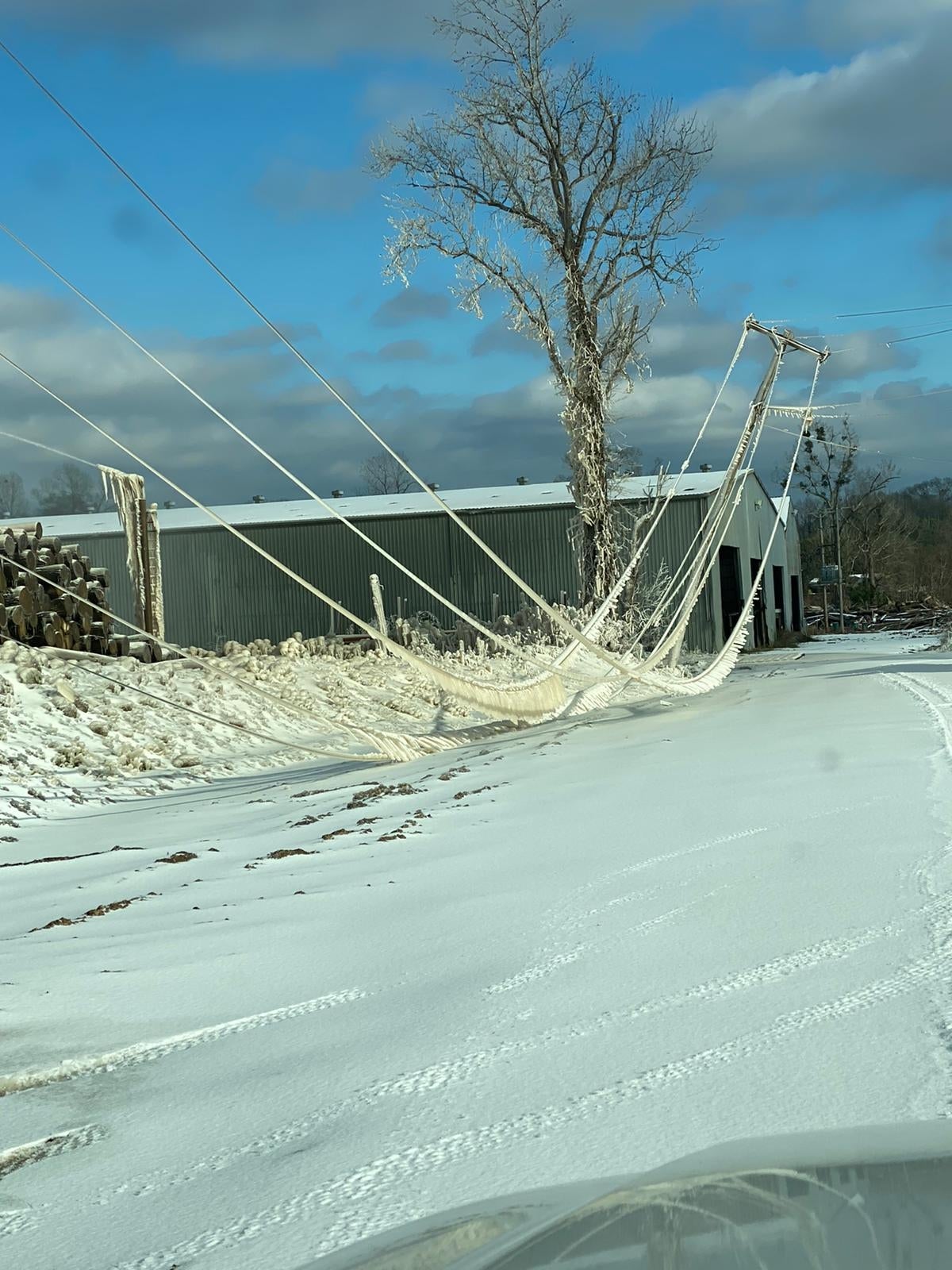
- Frozen power lines, likely caused by water sprinklers, could be seen near Jones Lumber Co. on Monday. Photo courtesy of Adams County Sheriff's Office.
|
Getting your Trinity Audio player ready...
|
NATCHEZ — Freezing temperatures around Southwest Mississippi are expected to last through Tuesday with tomorrow night being the coldest weather yet according to the Jackson National Weather Service.
Adams County received up to ½ inch of sleet and ice overnight Sunday, said Nicholas Fenner of the Jackson National Weather Service.
“The temperatures tonight are expected to plunge into the lowest we’ve had in quite some time at around 10 degrees,” Fenner said.
The last time the city of Natchez reported temperatures in the teens was in January 2018, according to National Weather Service data. The city reached 19 degrees on Jan. 16, 2018, 12 degrees on Jan. 17, 2018 and 10 degrees on Jan 18, 2018.
Frozen power lines could be seen nearly touching the ground by Jones Lumber Company. However, Entergy’s website is showing very few power outages in Adams County as of Monday afternoon.
“We’ll be going into Wednesday with ice still on the road.” Adams County Emergency Management Director Robert Bradford said, adding people should avoid driving until then as much as possible. “Even our first responders are having a hard time getting around.”
A few people in vehicles have gotten stuck while sightseeing or traveling to and from work, Bradford said, adding no major traffic accidents have occurred in the area.
Bradford said the Adams County Safe Room is open a warming shelter for anyone who needs it. As of Monday afternoon, the shelter has not been used by anyone for this weather event, Bradford said.
The Mississippi State Department of Health is rescheduling COVID-19 vaccines to next week or the week after for everyone who had an appointment scheduled at the Adams County Safe Room during the inclement weather, Bradford said.
Temperatures are expected to stay below freezing with a high around 32 degrees on Tuesday, Fenner said.
Wind chills as low as zero, give or take a few degrees, are also expected, Fenner said.
“Keep in mind with that kind of temperatures there are increased chances of hypothermia. If you must go outside, be sure to bundle up,” he said.
There is also a chance of exposed pipes and water lines bursting, Fenner said.
Wednesday is expected to be slightly warmer with a high around 40 degrees and another chance of additional freezing rain and sleet in the area on Wednesday afternoon and Thursday, Fenner said.
“Those who go out for whatever reason are likely to encounter slick roadways,” he said. “There is definitely a reason to be extra cautious and take your time on the roads. … Pay attention to the forecast over the next few days and be prepared for another winter event.”
More News


-
Polls
 Loading ...
-
-